Project Overview
The Amesbury Environmental Remediation Project is a result of the continued commitment by National Grid to monitor and address issues of environmental concern in Amesbury’s Lower Mill Yard under the Massachusetts Contingency Plan. Following significant environmental remediation efforts completed in the area in 2017, National Grid’s monitoring efforts led to the discovery of additional possible contamination beyond the original remediated site boundary.
As a result, National Grid is in the process of meeting with local property owners. National Grid will also work closely with local, state, and federal agencies including the Amesbury Conservation Commission, Amesbury Department of Community and Economic Development, Massachusetts Department of Environmental Protection, and the United States Army Corps of Engineers to ensure that any work is properly permitted and complies with environmental and other legal requirements.

Background
In the 1800s and early 1900s, numerous mills and industrial facilities operated by the Powwow River in Amesbury, MA in an area called the “Lower Mill Yard.” Among them was the former Amesbury Manufactured Gas Plant (“MGP”) located on 2.4 acres at the end of Water Street. The MGP operated from about 1899 to 1924, using coal and oil to manufacture gas.
The Amesbury Former MGP used industrial processes to produce gas from coal and oil. The community used the gas, often referred to as “town gas,” primarily for the same purposes that we use natural gas today. MGPs were common throughout the Northeast before the construction of the region’s natural gas pipelines. The gas production process often yielded by-products such as tars and oils. Some of these substances remained in the environment at former MGP sites after they ceased operations.
After MGP operations ceased, the City of Amesbury used portions of the area as a municipal landfill until 1952, followed by a local, private company that used it as an industrial landfill until the early 1960s. After landfilling operations concluded, part of the area was used for parking and the remainder was left as undeveloped, wooded wetland.
In 2004, National Grid started evaluating portions of the Amesbury Former MGP for potential contamination from MGP operations, and then conducted a clean-up of the contaminants in the ground under the Massachusetts Contingency Plan. National Grid completed the permitted and approved clean-up for the site in 2017. Today, the area is a revitalized wetland located between the Amesbury Riverwalk and the Powwow River.

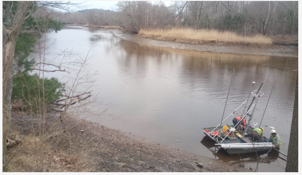
Since 2017, National Grid has continued to closely monitor the site and surrounding areas. These monitoring efforts and environmental assessments, which have included soil and sediment sampling, identified additional contamination beyond the original MGP site boundary, including within the Powwow River. This discovery serves as the impetus for planned additional remediation in the area.
Next Steps
National Grid has completed investigation activities to identify contamination beyond the original MGP site boundary, including within the Powwow River. The area of interest includes locations south of the initial Water Street location extending towards Macy Street along the Powwow River. The results of the investigations were recently included in a report (Phase II Report) that was submitted to MassDEP and a copy is posted in the Additional Resources / Public Notices section below. Investigations confirmed that contaminants remain in wetland, mudflat, and river sediments, primarily in deeper layers. Surface water is unaffected. Future cleanup plans will focus on removing the potential for people and wildlife to come into contact with contaminated sediments.
National Grid is also in the process of determining and prioritizing an appropriate remedy plan. The results of this remedy evaluation will be included in a report (Phase III Report) that is expected to be submitted to MassDEP in Winter 2026 and will also be posted in the Additional Resources / Public Notices section below.
National Grid is reaching out to property owners in this area and has initiated several aspects of the complex permitting that will be required for the Project. The specific timeframe for the cleanup activities is under development and will depend on coordinating property access, completing the evaluation of remedial action alternatives, and permitting the selected remedial action.
Additional Resources / Public Notices
Massachusetts Department of Environmental Protection Submitted Files Below:
- Phase IV Status Report (January 2026)
- Supplemental Phase II Comprehensive Site Assessment Report (October 2025)
- Phase IV Status Report (July 2025)
- Tier II Classification Extension Submittal (July 2025)
- Phase IV Status Report (January 2025)
- Phase IV Status Report (July 2024)
- Phase IV Status Report (January 2024)
- Phase IV Status Report (July 2023)
- Tier II Classification Extension Submittal (May 2023)
- Phase IV Status Report (January 2023)
- Phase IV Status Report (July 2022)
- Phase IV Status & Monitoring Report (July 2017)
- Phase IIII Remedial Plan & Phase IV Remedy Plan (October 2016)
- Phase II Site Assessment & Phase III Remedial Plan (July 2009)
National Grid anticipates that the project will be reviewed under the Massachusetts Environmental Policy Act (MEPA) as well as local, state and federal permitting agencies. As public hearing and participation sessions are scheduled, information will be posted below.
Community Outreach
National Grid is committed to keeping you informed of construction activities associated with the Project. For more information, please contact Kenneth Lento at 781-663-3123 or at Kenneth.Lento@nationalgrid.com